

|
Earthshine Sample Data 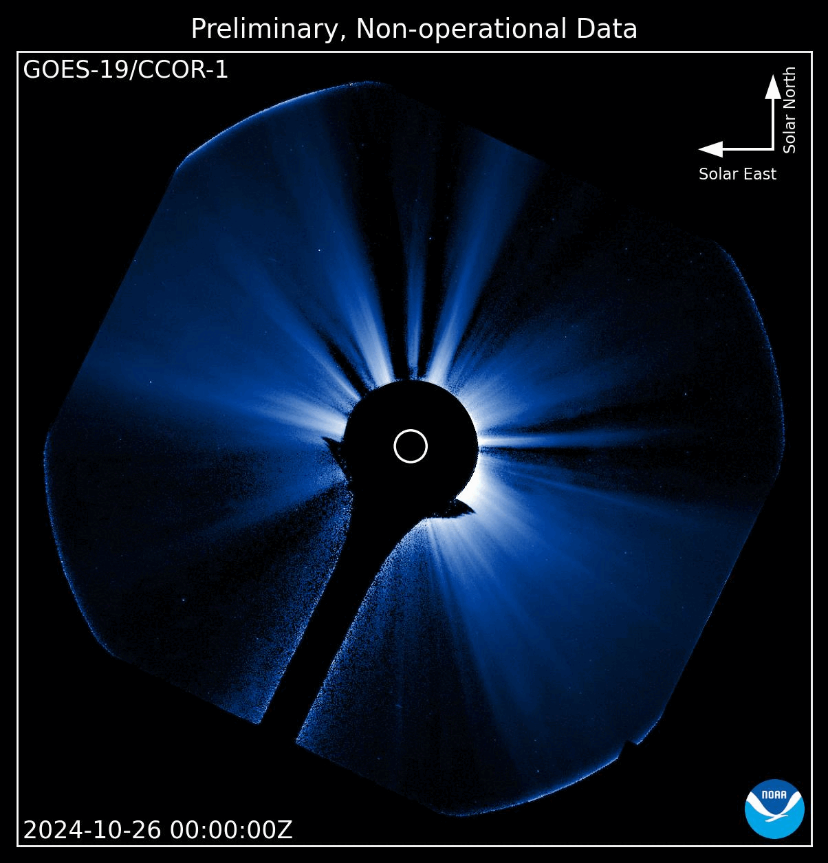
|
Earthshine Details The CCOR-1 instrument operates onboard the GOES-19 satellite in geosynchronous orbit at an altitude of 22,236 miles above the Earth’s surface. As a result of its proximity to Earth, sunlight that is reflected from the Earth’s natural albedo (e.g. clouds, snow, ice, oceans, etc..) can impact CCOR-1 observations. This reflected sunlight, called Earthshine, impacts CCOR-1 observations primarily during sunrise hours and the degree of the impact depends on the time of year. The effects are most pronounced around the equinoxes in March and September and gradually decay into the solstices. |
|
Decompression Sample Data 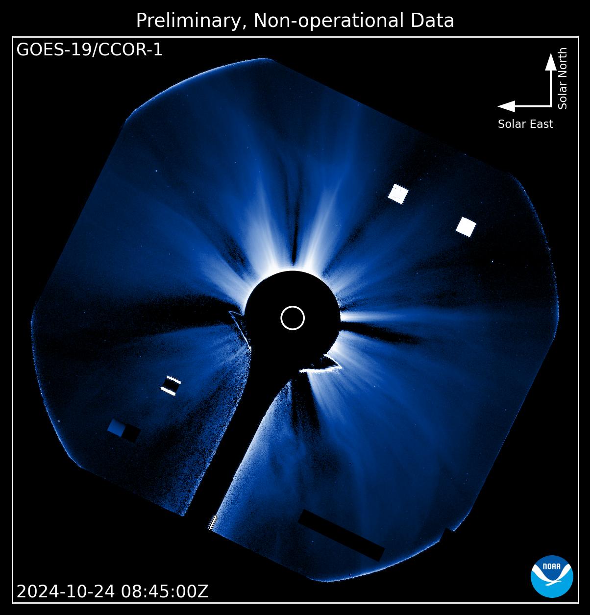
|
Decompression Details Images taken by the CCOR-1 instrument are compressed onboard using a custom compression scheme developed by the Naval Research Lab (NRL). When they are received on the ground, the data is decompressed as part of the ground processing algorithm (GPA). During the decompression process, issues can occur that result in bad blocks which manifest as bright or dark squares in the CCOR-1 image. |
|
Coarse Pointing Sample Data 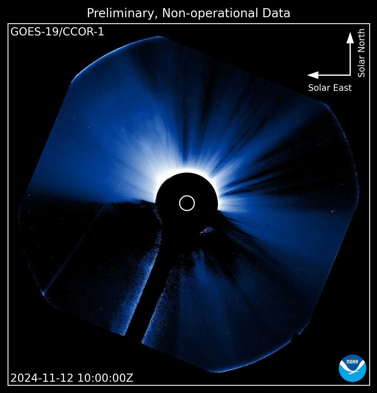
|
Coarse Pointing Details The CCOR-1 instrument operates onboard the GOES-19 satellite in geosynchronous orbit at an altitude of 22,236 miles above the Earth’s surface. As a result of its proximity to Earth, sunlight that is reflected from the Earth’s natural albedo (e.g. clouds, snow, ice, oceans, etc..) can impact CCOR-1 observations. This reflected sunlight, called Earthshine, impacts CCOR-1 observations primarily during sunrise hours and the degree of the impact depends on the time of year. The effects are most pronounced around the equinoxes in March and September and gradually decay into the solstices. |
|
Satellite Sample Data 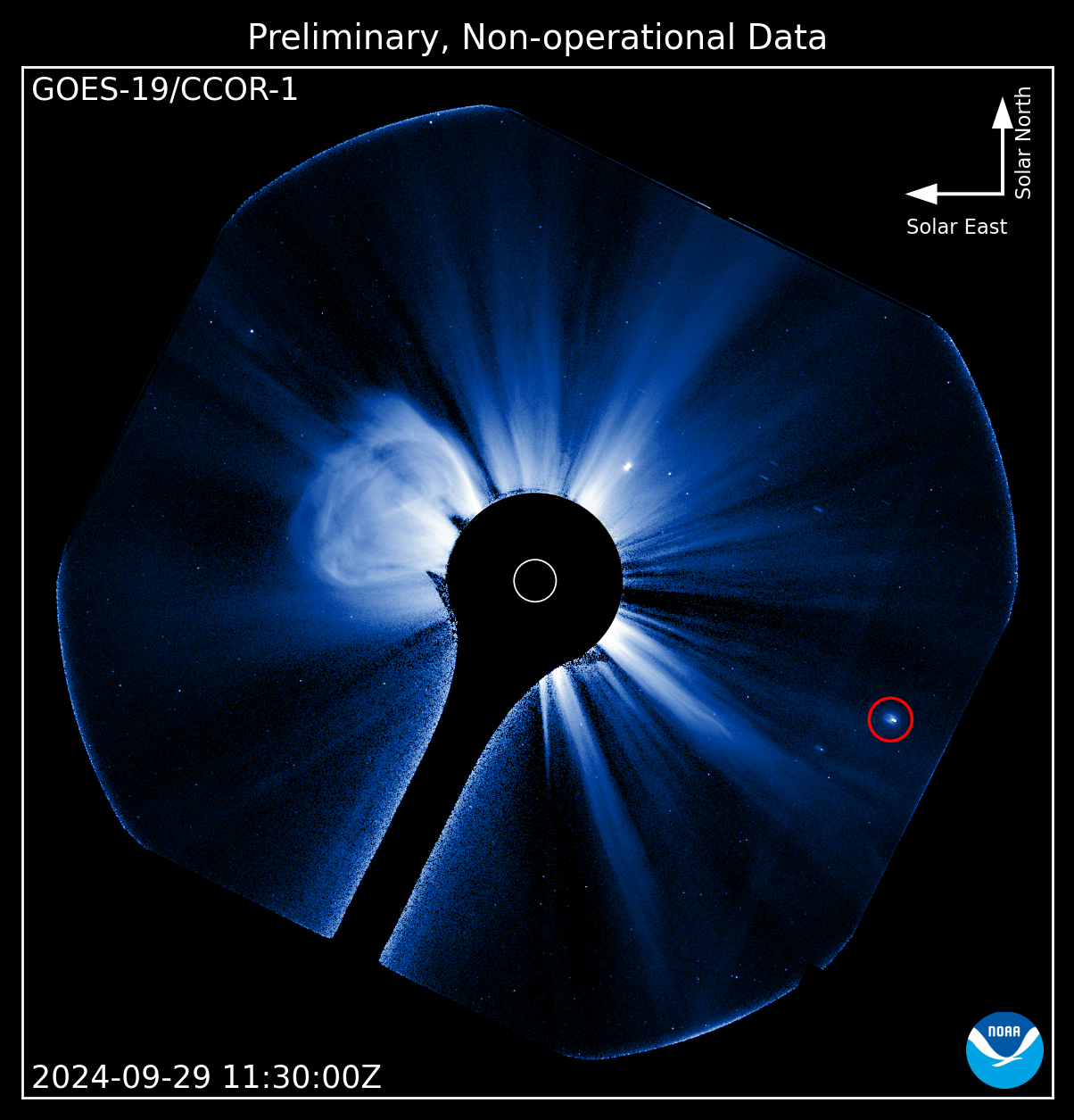
|
Satellite Details The CCOR-1 instrument is operating onboard the GOES-19 satellite in geostationary orbit at an altitude of 22,236 miles above the Earth. The proximity to Earth means that other satellites, on different orbits, can enter the field of view of CCOR-1. When this happens, the satellites show up as bright points that zip across the field of view of CCOR-1. |
|
Optical Ghosts Sample Data 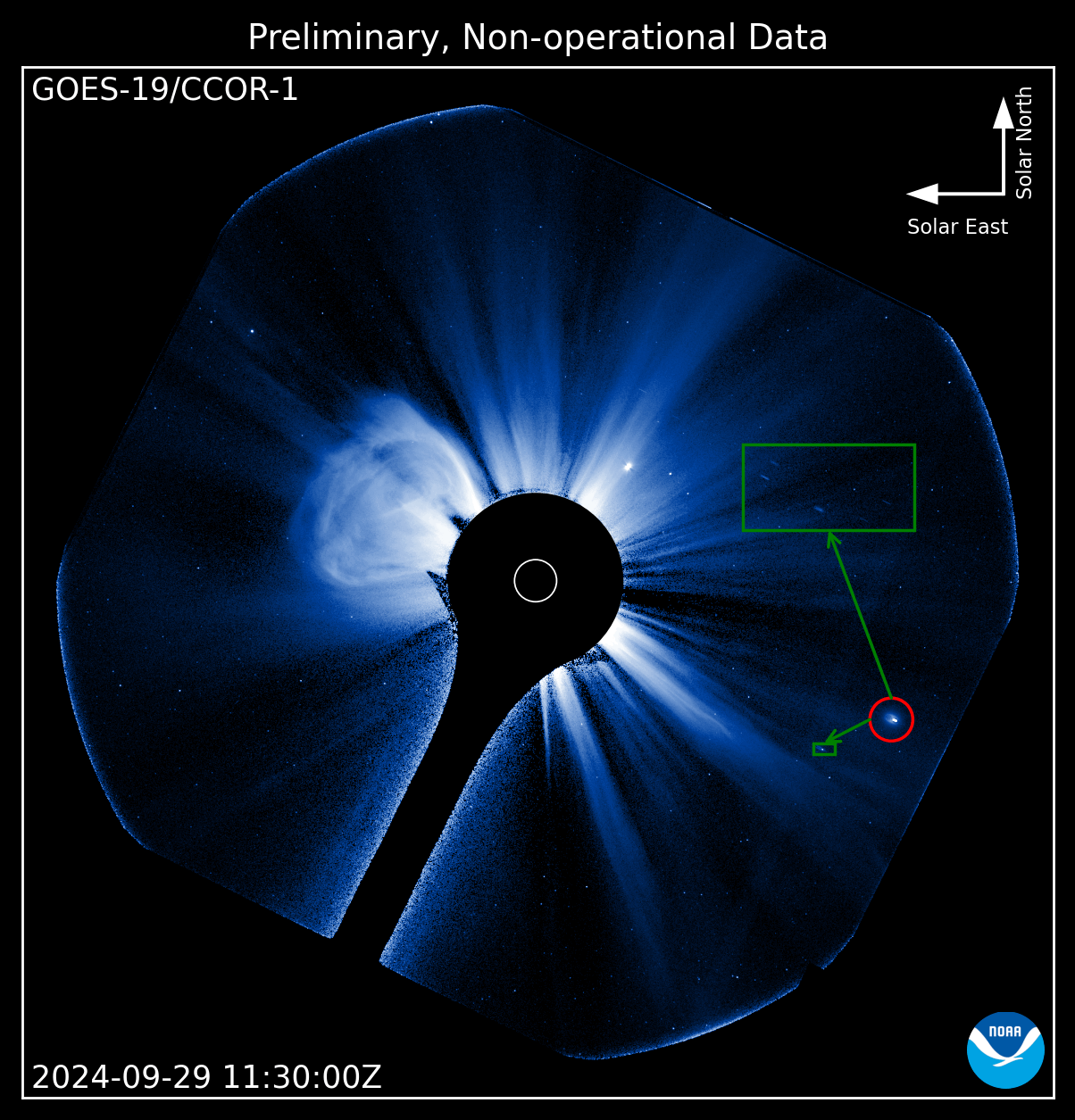
|
Optical Ghosts Details Optical ghosts are another type of artifact that can impact CCOR-1 images. This phenomena is caused by scattered light in the optical system and is associated with bright objects that can be either inside or just outside the field of view for CCOR-1. As these bright objects move across the field of view, so too do their associated optical ghosts. |
|
Planet Sample Data 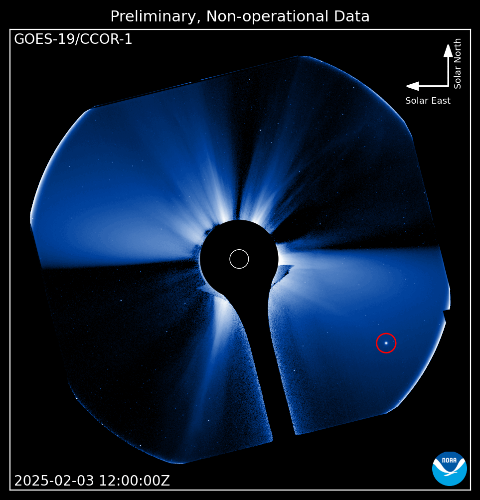
|
Planet Details TBD |
|
Comets Sample Data 
|
Comets Details TBD |
|
Moon Sample Data 
|
Moon Details TBD |