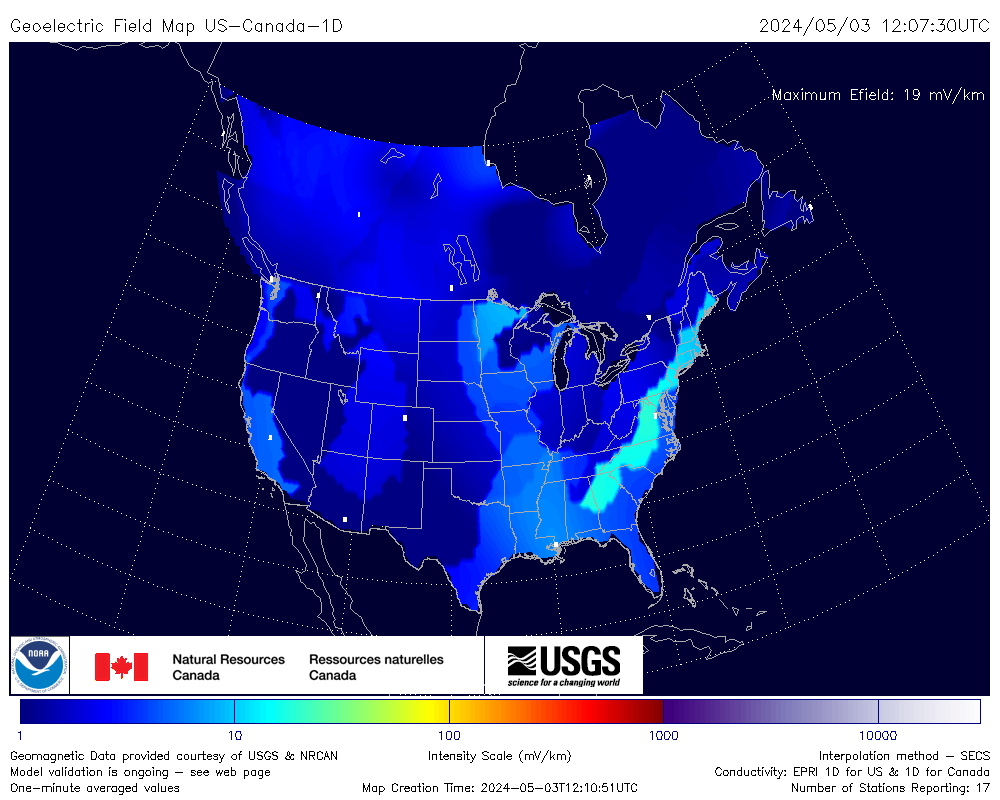
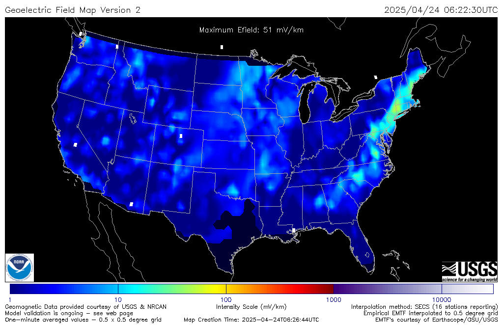
The geoelectric field is a measure of the induction hazard to man-made conductors, such as electrical power lines, that results from geomagnetic activity, and can be used to estimate the amount of current induced by integrating along the conducting pathway. The US-Canada-1D geoelectric field model uses 1D conductivity models over the lower 48 United States and over Canada up to 60 degrees latitude, with output spatial resolution of 1/2 degree in latitude and longitude. The empirical EMTF - 3D model uses transfer functions from MT surveys to specify the contribution of the Earth conductivity with increased accuracy (where available).
Local specification of the Geoelectric Field was identified by users in the electrical power industry as a critical need at SWPC's space weather workshop in 2011. Since then, through collaboration between SWPC, USGS, NASA/CCMC, and NRCAN, efforts have been devoted to meeting this important need. This parameter has also been identified as the key measure by the North American Electric Reliability Corporation in terms of Geomagnetic Disturbance mitigation. In particular, a benchmark Geomagnetic Disturbance Event has been defined and is being refined in terms of Geoelectric Field time series in order for the industry to carry out vulnerability assessments and mitigation measures. The quantity was also highlighted by the National Space Weather Action Plan from the Office of Science and Technology Policy of the President in the initial draft (October 2015) and through later versions of the plan.
Initial experimental release of the 1D Geoelectric Field Maps (graphics) occurred in October 2017 and full deployment to SWPC operational systems occurred on September 17, 2019. Data values are available on request.
The upgrade using EMTF-based conductivities became experimental in June 2020 and went operational in September 2020.
An update to the EMTF-based E-field product was accomplished in March 2022, based on the addition of new surveys published at the IRIS-EMTF web page. The primary change is increased coverage in the southwestern part of the continental United States.
On June 15, 2023, the joint US-Canada 1D model was deployed to operations, replacing the original Fernberg 1D model. In addition the 3D empirical model was updated to incorporate recent survey results from the IRIS database that were publicly available as of December 2022, further increasing the model coverage over CONUS.